Bohemia
Mariners' Museum, Uncurated Search Results
Type: Schooner
Year:
Builder:
Location:
These records are found in the online catalog of The Mariners’ Museum and Park in Newport News, Virginia. Uncurated search results are presented to give researchers and interested readers an idea of whether the museum’s archives contain information about this vessel and whether it may be worthwhile to visit the museum’s catalog search page for further investigation. Uncurated results may be inaccurate or incomplete.
Search mode: Exact Name. Search phrase(s): "Bohemia". Results returned: 24. Results displayed in this table: 24.
Use these buttons to send uncurated search results to your own app or text document for further research. First, check the box for any row, or click "Select All" then uncheck any rows. Then click "Show Selections". You can then copy your selections from the text box and past them into your app.
| Fetch? | Row ID | Media | Date | Vessel | Place | Related Places | Inscription/Marks | Subject | Notes | Archive Number |
|---|---|---|---|---|---|---|---|---|---|---|
| 1 | No image URL. | Bohemia (Schooner : 1884). | Schooners. | Bohemia story. | LB105124 | |||||
| 2 | No image URL. | Bohemia (1875) | P0001.011/01-0413 | |||||||
| 3 | 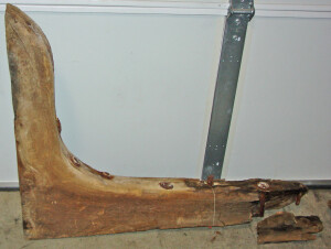 | NOTES: The knees were removed from the hulk of the vessel in February 1959 and mounted in arch ways of the museum's main room after being cleaned. LABEL COPY: Ship's Knees Deck knees from the two-masted schooner BOHEMIA, built 1884 at St. Michaels, Maryland. Served on the Chesapeake Bay as a trader and oyster dredger until abandoned in Sarah Creek, Virginia, about 1953. Gift of Captain M.L. Tillage/ VF 66 ADDITIONAL INFORMATION: See object file for description of how these were attached to entrance-way between Great Hall and the Chesapeake Bay Room. VESSEL INFORMATION-- VESSEL NAME: Bohemia VESSEL TYPE: Two masted schooner SERVICE DATES: 1884-1953 BUILDER LOCATION: Maryland, St. Michaels ASSOCIATED PLACE: Chesapeake Bay VESSEL HISTORY: Used in freighting and as an oyster dredger on Chesapeake Bay waters until about 1953 when she was abandoned in Sarahs Creek, Gloucester County, Virginia. | CL856 | |||||||
| 4 | 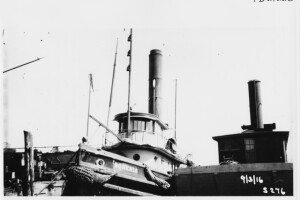 | April 3, 1916 | WRITTEN ON VERSO: BUILT 1898 AT PHILADELPHIA;PHIA BY NEAFIE & LEVY.OWNED BY SOUTHERN TRANSPORTATION COMPANY. 117T, 84.6 X 19 X 8.8. DISMANTLED 1956 | Tugboats | Port bow quarter view of vessel tied to pier. original print in album, page 16. | MS0224/01-#PB21228 | ||||
| 5 | 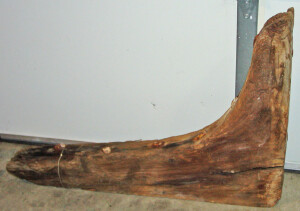 | NOTES: The knees were removed from the hulk of the vessel in February 1959 and mounted in arch ways of the museum's main room after being cleaned. LABEL COPY: Ship's Knees Deck knees from the two-masted schooner BOHEMIA, built 1884 at St. Michaels, Maryland. Served on the Chesapeake Bay as a trader and oyster dredger until abandoned in Sarah Creek, Virgninia, about 1953. Gift of Captain M.L. Tillage/ VF 66 ADDITIONAL INFORMATION: See object file for description of how these were attached to entrance-way between Great Hall and the Chesapeake Bay Room. VESSEL INFORMATION-- VESSEL NAME: Bohemia VESSEL TYPE: Two masted schooner SERVICE DATES: 1884-1953 BUILDER LOCATION: Maryland, St. Michaels ASSOCIATED PLACE: Chesapeake Bay VESSEL HISTORY: Used in freighting and as an oyster dredger on Chesapeake Bay waters until about 1953 when she was abandoned in Sarahs Creek, Gloucester County, Virginia. | CL859 | |||||||
| 6 | 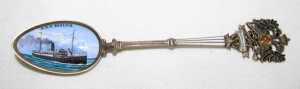 | SHORT DESCRIPTION: On the spoon is a view of the BOHEMIA in colors. At the top is a crest of double eagles under which is written OESTERR LLOYD. VESSEL INFORMATION- VESSEL NAME: BOHEMIA VESSEL TYPE: STEEL SCREW SCHOONER VESSEL BUILT 1896 SHIP BUILDER: LLOYD AUSTRIACO SHIP OWNER: LLOYD AUSTRIACO VESSEL DIMENSIONS: 375.4 x 44.0 x 19.5 Alternate vessel names: (1) BOHEMIA (1896-1917); (2) HWAH PING (1918-1933); (3) POO AN (1934-1935). | CL1702 | |||||||
| 7 | 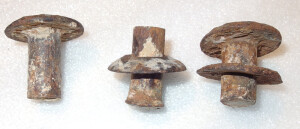 | NOTES: Several fragments tied together. VESSEL INFORMATION-- VESSEL NAME: BOHEMIA VESSEL TYPE: Two masted schooner SERVICE DATES: 1884-1953 BUILDER LOCATION: Maryland, St. Michaels ASSOCIATED PLACE: Chesapeake Bay VESSEL HISTORY: Used in freighting and as an oyster dredger on Chesapeake Bay waters until about 1953 when she was abandoned in Sarah Creek, Gloucester County, Virginia. | CL25178 | |||||||
| 8 | No image URL. | NOTES: The knees were removed from the hulk of the vessel in February 1959 and mounted in arch ways of the museum's main room after being cleaned. LABEL COPY: Ship's Knees Deck knees from the two-masted schooner BOHEMIA, built 1884 at St. Michaels, Maryland. Served on the Chesapeake Bay as a trader and oyster dredger until abandoned in Sarah Creek, Virgninia, about 1953. Gift of Captain M.L. Tillage/ VF 66 ADDITIONAL INFORMATION: See object file for description of how these were attached to entrance-way between Great Hall and the Chesapeake Bay Room. VESSEL INFORMATION-- VESSEL NAME: Bohemia VESSEL TYPE: Two masted schooner SERVICE DATES: 1884-1953 BUILDER LOCATION: Maryland, St. Michaels ASSOCIATED PLACE: Chesapeake Bay VESSEL HISTORY: Used in freighting and as an oyster dredger on Chesapeake Bay waters until about 1953 when she was abandoned in Sarahs Creek, Gloucester County, Virginia. | CL857 | |||||||
| 9 | No image URL. | NOTES: The knees were removed from the hulk of the vessel in February 1959 and mounted in arch ways of the museum's main room after being cleaned. LABEL COPY: Ship's Knees Deck knees from the two-masted schooner BOHEMIA, built 1884 at St. Michaels, Maryland. Served on the Chesapeake Bay as a trader and oyster dredger until abandoned in Sarah Creek, Virgninia, about 1953. Gift of Captain M.L. Tillage/ VF 66 ADDITIONAL INFORMATION: See object file for description of how these were attached to entrance-way between Great Hall and the Chesapeake Bay Room. VESSEL INFORMATION-- VESSEL NAME: Bohemia VESSEL TYPE: Two masted schooner SERVICE DATES: 1884-1953 BUILDER LOCATION: Maryland, St. Michaels ASSOCIATED PLACE: Chesapeake Bay VESSEL HISTORY: Used in freighting and as an oyster dredger on Chesapeake Bay waters until about 1953 when she was abandoned in Sarahs Creek, Gloucester County, Virginia. | CL858 | |||||||
| 10 | No image URL. | Bohemia (1884 File 3) | P0001.011/01-0416 | |||||||
| 11 | No image URL. | Bohemia (1884 File 4) | P0001.011/01-0417 | |||||||
| 12 | No image URL. | Bohemia (1884 File 1) | P0001.011/01-0414 | |||||||
| 13 | No image URL. | Bohemia (1884 File 2) | P0001.011/01-0415 | |||||||
| 14 | No image URL. | Germany–Description and travel; Netherlands–Description and travel.; Bohemia (Czech Republic)–Description and travel. | Lakes–Germany; Yachting. | Our wherry in Wendish lands : __from Friesland through the Mecklenburg lakes, to Bohemia __by H.M. Doughty ... illustrated by his daughters | LB8880 | |||||
| 15 | No image URL. | Luces de bohemia : __artistas, gitanos y la definicion del mundo moderno | LB100679 | |||||||
| 16 | 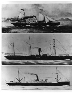 | WRITTEN ON VERSO: ARCHIMEDE (Steamship) Built 1832 at Genoa, Italy. 180 T. Rebuilt as, (a)AGLAJA 1879. Rebuilt as BOHEMIA (Steamship) 1896 at Trieste, Italy, by Lloyd Austriaco. Owned by same. 4,318 T. 375.4x44x19.5. Renamed Hwah Ping. Out of LR 1934-35. | MM copy from ''Ship Through the Ages" | P0001.003/01-#PB26561 | ||||||
| 17 | 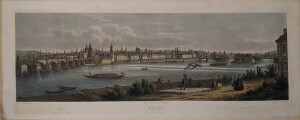 | SHORT DESCRIPTION: Hand colored engraving showing a view of Prague's old and new towns from the Kampa across the Vltava (Moldau) River. The Charles Bridge sits at the left and the Chain Bridge sits at the right. NOTES: The Charles Bridge is shown at the left. It was constructed starting in 1357 under the auspices of King Charles IV, and finished in the beginning of the 15th century. The bridge replaced the old Judith Bridge (built 1158-1172) after it was badly damaged by a flood in 1342. It was originally called the Stone Bridge (Kamenný most) or the Prague Bridge (Pražský most), and has been known as the "Charles Bridge" since 1870. As the only means of crossing the river Vltava until 1841, the Charles Bridge was the most important connection between Prague Castle and the city's Old Town and adjacent areas. NOTES: At this time this print was created Prague was located in Bohemia. | CL10617 | |||||||
| 18 | 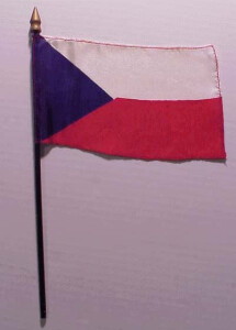 | SHORT DESCRIPTION: Miniature flag attached to miniature flagpole. | CL27695 | |||||||
| 19 | 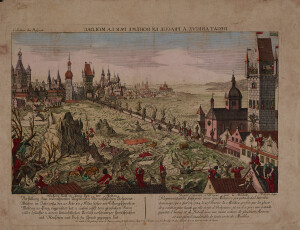 | SHORT DESCRIPTION: Hand colored engraving, vue optique titled 'Degat Arrive a Prague en Boheme par la Moldau' showing the February 27, 1784 flood of the Vltava River (Moldau). Drawn by Johann Baptist Bergmüller, engraved by Jean Benoit Winckler, and published by the Kaiserliche Franziskische Akademie in Augsburg, Germany. The image shows the historic Charles Bridge at the center. The upriver side of the bridge is full of large blocks of ice, floating houses, people, cattle, trees and people in boats. In the foreground at the bottom left corner numerous people cling to the branches of a tree and people sit on rooftops appearing to beg for assistance. In the bottom right corner a man's lower body hangs out of a window and the letters "BF" (probably the abbreviation for "Bergmüller fecit") appear above the window. Descriptive text in German and French are below the image. NOTES: During a flood of 1784, five pillars of the bridge were severely damaged but the arches did not break down. ROUGH TRANSLATION: “Damage Arrives in Prague in Bohemia via the Moldau River” “Representation made from a real-life memory of the horrible damages that occurred February 27, 1784. The Moldau River overflowed more than usual from the glaciers, and where a large quantity of people and livestock perished with entire houses ruined and a considerable loss of furniture. Sold at Augsburg in the common trade of the Imperial Academy of the Empire under its Privilege and with the prohibition to neither make nor sell copies.” NOTES: (Martha R. Wyatt, March 2001) Vue Opitques- A special type of popular print published in Europe during the 18th century. These prints were a form of entertainment meant to be seen through devices called "optical machines," "optiques," "zograscopes," or "peepshows." The prints were exhibited by traveling showmen in the streets throughout Europe and were also collected by those in the professional and upper classes who had the optical machines at home. There was a great curiosity about the appearance of unvisited European cities and exotic locations in the further reaches of the globe, and these prints were one of the only ways the general public could get a look at the wider world. When displayed in the optique, the prints were able to transport the viewer into a far away place-an unknown city, or perhaps into the midst of a dramatic bit of contemporary history or to the distant past. While some of these prints are based on first hand drawings, others are strictly imaginary or at least untruthful. The artists who etched them usually copied other prints or paintings and were quite unabashed in their willingness to take a beautiful , unnamed harbor from a painting by Claude Lorrain and call it, for example, Rotterdam. NOTES: [J. Willoz-Egnor, 1/5/2023] The publication/copyright line "Se vend à Augsbourg au Negoce commun de l'Academie Imperiale d'Empire des Arts libereaux avec Privilege de Sa Majeste Imperiale et avec Defense ni d'en faire ni de vendre les Copies" identifies the publisher as the Kaiserliche Franziskische Akademie which was active in Augsburg, Germany at least between 1775 and 1785. Other sources say the publisher was only active until 1779, but several images in our collection attributable to this publisher depict events that date to 1784 (LE 233, LE 237 and LE 247). | CL10657 | |||||||
| 20 |  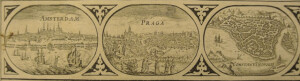 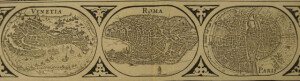 | 1634-1649 | Europe | "à Guilielmo Blaeuw" | Map depicts city views along the top of map (Amsterdam, Prague, Constantinople, Venice, Rome, Paris, London, Toledo, Lisbon); illustrations of people's dress along right and left of map (English, Gallic, Belgium, Castilians, Venetians, Germans, Hungarians, Bohemians, Polish, Greek); small illustrations of ships, sea monsters, and Neptune in the water, illustrations of two lions on Africa, and illustration of three bears in Northern Europe/Russia; the mythical island of Frisland appears between Iceland and Greenland; no color. This map was was originally printed for either the 1634, 1635, 1638, 1641, 1642, 1647, 1648, or 1649 German editions of Blaeu's Theatrum Orbis Terrarum. Other version of the map also appeared in his Grand Atlas; however, German versions of the Grand Atlas were most likely recompiled from the Theatrum Orbis Terrarum. From John Goss, ed. Blaeu's The Grand Atlas of the 17th Century World (London: Rizzoli, 1990), 30.: "The atlases compiled and published by the Blaeu's and other mapmakers, as a rule included general mpas of the then known continents: Europe, Asia, Africa and America, usually conceived as a uniform group. This is Willem Blaeu's map of the continent of Europe which dates back to 1617, although the date was removed from later printings prior to the inclusion of the map in the first ofa long series of World atlases which begam to appear in 1630. That date marks the first atlas publication of this and the other continental maps . . . Uniform in both style and layout with the other continental maps, Europe is embellished with ornamental borders: the side borders showing costume vignettes representing England, France, The Netherlands, Castille, Venice, Germany, Hungary, Bohemia, Poland and Greece. The upper frieze shows nine town views, respectively Amsterdam, Praha, Constantinople, Venezia, Roma, Paris, London, Toledo, and Lisboa." Dr. Ir. C. Koeman, Joan Blaeu and his Grand Atlas (Amsterdam: Theatrvm Orbis Terrarvm, 1970). | MSM 1/-#0902 | ||||
| 21 | 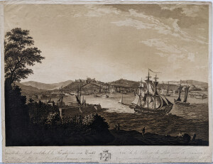 | VUE DE LA VILLE ET DU PORT FRANC DE TRIESTE | CL8185 | |||||||
| 22 | No image URL. | United States Lines Company.; Dollar Steamship Lines. | Europe, Eastern–Emigration and immigration–History–20th century.; United States–Emigration and immigration–History–20th century. | Steamboat lines–United States.; Merchant marine–Passenger traffic.; Shipping–Mergers–United States. | This collection features twenty-three pages of correspondence to, from, or held by Charles Krcilek, a General Agent for the United States Lines. The material covers general business gossip primarily concerning the sale of United States Lines to Roosevelt-Dollar Lines, and to a lesser degree, eastern European immigration numbers. It should be noted that two items of this collection are in Czech. | MS0117 | ||||
| 23 | No image URL. | Europe–Description and travel | Geography | Translation by Patrick Murdoch of part of the author's "Neue erdbeschreibung" relating to the European countries. Includes index in v. 6. | LB31266 | |||||
| 24 | 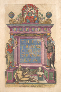 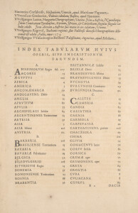  | America–Maps–Early works to 1800. | Scales differ. | Geography, Ancient–Maps.; Names, Geographical.; Geography–Early works to 1800.; Cartography–Early works to 1800.; Geography, Ancient–Early works to 1800. | Reprint of the first, 1570 edition of the Theatrum orbis terrarum of Abraham Ortelius, which is generally considered to be the first modern printed atlas. Colophon: Antverpiae, in officina Plantiniana, auctoris are & cura, 1592. Catalogus authorum includes 153 names. Engraved title page, within ornamental border. "Parergon, sive Veteris geographiae aliqvot tabvlae" and "Nomenclator Ptolemaivs", latter dated 1591. Includes map of the world; maps of the continents known to Europeans at the time; and more detailed country and regional maps, primarily within Europe, although also in North Africa and the Near East. Each map is preceded by descriptive text. Supplementary material includes De Mona druidum insula, an essay (sent to Ortelius in a 1568 letter) by Welsh historian and cartographer Humphrey Llwyd; a list of cartographers whose works Ortelius consulted or knew of; and a detailed index. Imprint from colophon./ Engraved title page, with printed epigram on verso./ The second issue of the first edition of the first modern atlas. Cf. Skelton./ The maps are numbered 1-108, indicated at the bottom of epigram, forming two conjugate leaves each; the front of the first leaf with printed text and plate number, the reverse of the second leaf always blank. Relief shown pictorially. All editions of the Theatrum have a common structure. The single-volume atlas opens with an allegorical title page depicting the five continents then known as native goddesses. There follows a dedication to Philip II, King of Spain and the Netherlands; a poem by Adolphus Mekerchus (Adolf van Meetkercke), on the title page; a portrait of Ortelius by Philip Galle (in editions of 1579 and later); an introduction by Ortelius himself; a letter of recommendation by Mercator; the list of sources ("Catalogus Auctorum"); an index of regions and place-names ("Index Tabularum"); the atlas proper, consisting of maps with accompanying text on the verso; a register of place-names in antiquity ("Nomenclator"); a treatise ("De Mona Druidum", by Humfred Lhuyd); and finally the privilege and a colophon. 3 parts in one volume, folio (425 x 282mm.), Hand-colored engraved title page heightened in gold, hand-colored portrait of Ortelius, and 134 double-page maps, The present edition contains 108 hand-colored double-page maps in the Theatrum as well as the 26 maps and views of the Parergon, all in contemporary hand-coloring. The text provides detailed discussions of each map which cite both ancient and modern authorities, marrying the ancient geographers with the new eye-witness accounts of Coronado, Cartier, Thevet, and more. Notably, he gives credit generously to those whose data he uses; the first edition names 87 sources, with more added in each edition. This is one of the first editions of the Theatrum with a clear division into three parts: (1) the atlas itself, (2) the Parergon, and the Nomenclator. The Parergon had for the first time its own title page. For this title page Plantin made use of the woodblock he had used for the title page of Genesis in the Biblia Regia, printed in 1569-72. Printing started in July 1590 but because of a shortage of paper the printing lasted longer than expected. The Nomenclator was printed between February and May 1591 (the title page was dated 1591). The rest of the Theatrum was printed in the summer of 1591. The first copies were delivered on 6 August 1591. The colophon however has the date of 1592. The Plantin Press printed 525 copies of this edition. After this edition, only the fifth Additamentum would further enlarge the Theatrum. Relief shown pictorially.; "Ab. Ortelius describ. cum priuilegio decennali 1587."; The border of clouds found in earlier editions has been replaced by an intricate and elaborate border framing the title, three quotations from Cicero, and two from Seneca.; The oval world map used previously has been updated to more accurately portray South America and to add the Solomon Islands.; Includes (on half of verso under title Orbis terrarum and numbered "I") descriptive text and names of geographers, both ancient and contemporary, whose works were consulted in making the map. The first edition of the atlas was completed in the year 1569, and in May of 1570, the Theatrum was available for sale. When published, the word atlas was not in use yet. It was one of the most expensive books ever published. It contained seventy maps on fifty-three sheets.The maps were engraved by Franciscus Hogenberg. Later editions included Additamenta (additions) that later resulted in Ortelius' historical atlas, the Parergon, mostly bound together with the atlas. The Parergon can be called a truly original work of Ortelius, who drew the maps based on his own research. The importance of the Theatrum Orbis Terrarum for geographical knowledge in the last quarter of the sixteenth century is difficult to overemphasize. There was nothing else like it until Mercator's atlas appeared twenty-five years later. Demand for the Theatrum was remarkable. Altogether some 24 editions appeared during Ortelius's lifetime and another 10 after his death in 1598. The Theatrum Orbis Terrarum was so successful that it had to be reprinted four times in its first year of publication. Altogether the atlas was published in 42 editions from 1570 to 1612 and in 7 languages - Latin, German, Dutch, French, Spanish, English and Italian. The number of map sheets grew from 53 in 1570 to 167 in 1612, in the last edition. In 1577, engraver Philip Galle and poet-translator Pieter Heyns published the first pocket-sized edition of the Theatrum, the Epitome. Over thirty editions of this Epitome were published in different languages. The later editions after 1598 were published by Jan Baptiste Vrients. He had bought the publication rights from the heirs of Ortelius. Imprint from colophon. Colophon: Antverpiae, in officina Plantiniana, auctoris are & cura, no date/ Engraved title page, within ornamental border./ "Parergon, sive Veteris geographiae aliqvot tabvlae" and "Nomenclator Ptolemaivs", latter dated 1591, have special title pages; "De mona drvidvm insvla ... epistola", by H. Lhuyd [7] p. at end/ Imprint from colophon. | LB107335 |
Created 2026 by Don Barker, CBMM volunteer, for the Chesapeake Shipbuilding Project. shipbuilding@sailingworkboats.es